|
Cemetery
Reading
| |||||||||||||||||||||||||||||||||||||||||||||||||||||||||||||||||||||||||||||||||||||||||
| Cemetery Name: |
Rankin Hill |
Click on image image above for |
| County: | Mason | |
| USGS Quad: | Robertsburg | |
| Coordinates: | 38.7675ºN -82.0144ºW | |
| Maintained by: | not maintained | |
| Land owner: | Lannes Williamson Pallet Company | |
| Date added to WVCPA register: | September 2005 | |
| Condition of cemetery**: | Abandoned (August 2005) | |
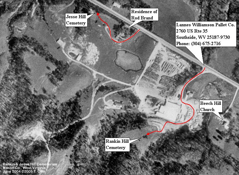
| Accessibility: | This is a small cemetery located at Southside in Arbuckle District. The photo above identifies where it is located in relation to the main highway. After you turn into Lannes Williamson Pallet Co. (and let someone there know what you're up to!), walk around the left side of the building and back around the rear till you see a small rock cliff. Walk up the hill from the left of the cliff until you see the clearing and an opening through the fence. See "Comments" section at the bottom of this page for more details. | |
|
** Condition of cemetery as
observed on the given date - |
||
| Last Name: | First Name: |
Born: |
Died: |
Inscription: |
Photo: |
Source: |
| Hill | Davie | 1871 | 1959 | |||
| Hill | Laura | 1869 | 1957 | |||
| Hill | Maria Stephens | 15 February 1831 | 17 June 1904 | |||
| Hill | Rankin J. | 7 May 1855 | 2 November 1935 | |||
| Hill | Sen. Byrd | 7 January 1862 | 7 November 1906 | |||
| Hill | Oma | 1874 | 1950 |
| Comments: |
Dates or names in Red
are not inscribed on the tombstone and have either been calculated based on
death date or are as a result of research on the individual.
Thanks to the generous research and photography of WVCPA contributor, Tracy Cain, we have the photos above to present to you. When he visited the cemetery last in June 2004, there was only one marker visible, that of Maria Stephens Hill. This cemetery was last read by Mrs. Lannes Williamson, (who lives on the farm where this cemetery is located, of the Williamson family that owns the Pallet Co.) in August 1970. Any updates and photos are most
welcome. Contact us at The photos below, in order left to right, top to bottom, and the directions from Tracy Cain printed with them will help you find your way to the Rankin Hill Cemetery. Click on the photos below to view full size. |
|

|
<< View of the Lannes Williamson Pallet
Co. - the cemetery is
|
|
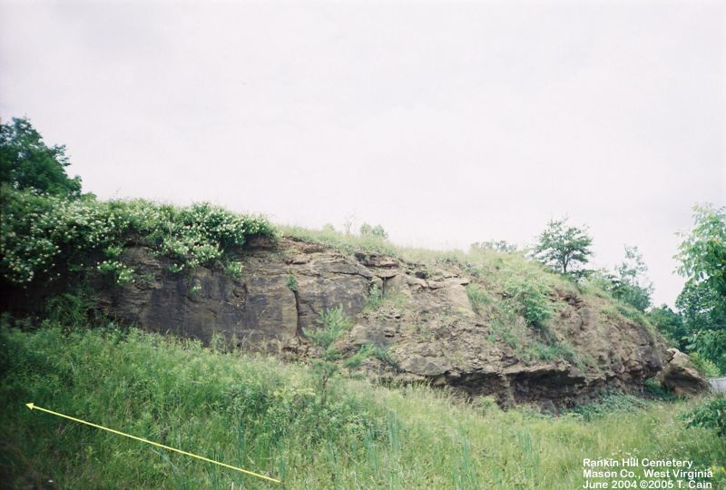
|
Behind the mill building
you will see a rock cliff -
|
||
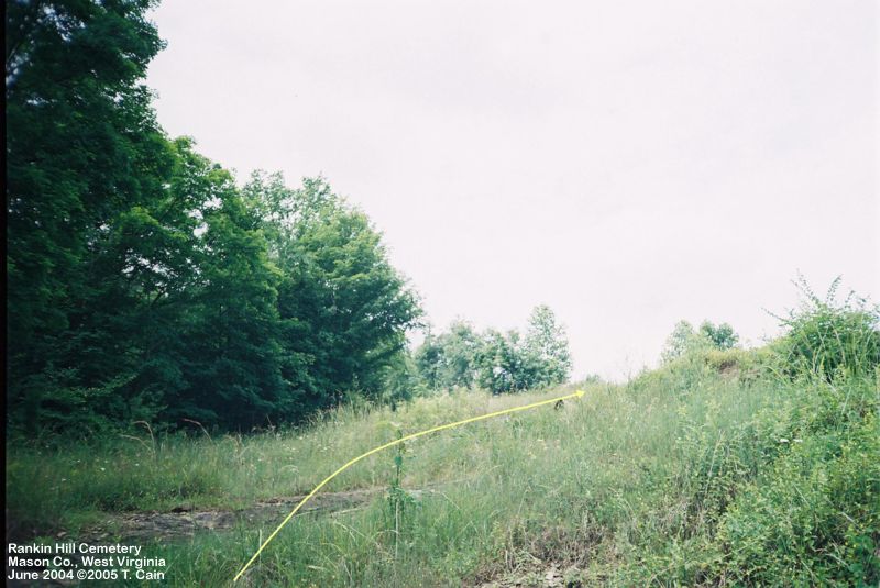
|
<< From there, continue up
the flank of the hill, up and towards
|

|
|
|
||
|
|
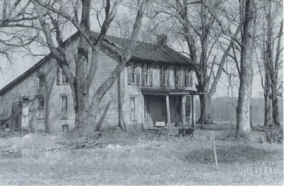
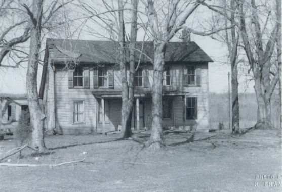
The black and white photos on the
left and right here are of the Linzy Hill farmhouse, once located nearby the
Rankin Hill, and particularly the Jesse Hill, cemeteries. Linzy (or
Lindsey, as some researchers spell it) was a descendant of Jesse and Rankin
Hill. The photographer, Rod Brand (descendant of Linzy Hill), and his wife
Irene have their home located where this farmhouse once stood. These
photos were taken nearly 50 years ago when the farmhouse was still
standing. "...We don't really know a
lot about it, except that it was the home of Linzy Hill. I suspect it
was built around 1850; possibly into the sixties. It was of post &
beam construction. Huge hand hewn timbers that were mortised and pinned
at the corners, with braces... all of oak wood, of course. It may very
well have been built by Jesse Hill, but we do not know; but from its' style
etc., and the dates he lived on this farm, it was probably "the old Hill
homeplace" to his children. Rod Brand, in letter to Tracy Cain, in 2004 |
|
![]()
![]()
![]()
![]()
![]()
![]()
![]()
![]()
![]()
![]()
![]()
![]()
![]()
![]()
Updated: 07 September 2012